The Real Story Behind The Course Location Names At Pikes Peak
COLORADO SPRINGS, CO — (News Release) With 156 turns on the race course, many locations and corners were named over the years so they could be used as reference points. How did these course locations earn their labels? Most have documented history. Others have roots in local lore.
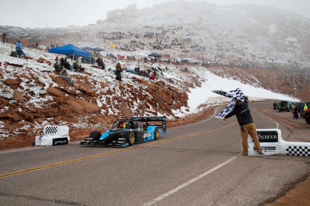
Start Line: Start of the Pikes Peak International Hill Climb, elevation 9,390 feet.
Crystal Work Road: This is the gravel pit road on the left. It was used to check the headwaters at Crystal Reservoir.
Hansen’s Corner: George Hanson once closed the road at this point because he owned this section. The case ended up in court and it was ordered that George be paid before it was re-opened.
8 Mile Pit Road: This road led to a gravel pit once used to redo and maintain the road. The gravel pit is now closed.
Horseshoe: Parking area to the left that looks like a horseshoe.
Engineers Corner: This corner was the nemesis of many drivers who failed to negotiate the turn and went off the road. Someone once said, “You have to be an engineer to make it around that corner!”
Halfway Picnic Grounds: This area is halfway between the Start Line and Glen Cove. Years ago, when Pikes Peak tours were given on horseback, riders would be told that they were now halfway. This is the fastest part of the racecourse.
Gayler’s Straits: Tom Gayler, former Pikes Peak highway manager, was delivering a can of gas to a man near the top, but fell asleep at the straits. His vehicle rolled three times, but amazingly he was not severely injured.
Brown Bush Corner: There was once a brown bush on this corner, located on the right. This marked the first switchback on the course. Landscapes change, but the name remains.
Big Spring: There is a natural spring here that usually runs all year and now drains into a culvert that goes underneath the road.
Blue Sky: Years ago all you could see was “blue sky” as you came into this left-hand corner.
11 Mile Water Station: In the past, there were water standpipes with faucets and hoses here so people could cool down their radiators. With innovations in automotive cooling systems, these are long gone.
Heitman’s Hill: Chuck Heitman, Assistant to the Colorado Springs City Manager, was coming down the hill with a big dragline, got too close to the outside edge and rolled over. He bailed out, hurting nothing but his pride.
Grouse Hill: For years a flock of grouse lived in this area, and could usually be spotted in the morning.
Gilly’s Corner: Gilly, a Pikes Peak Highway Patrolman, rolled his car on this corner.
Ski Area: The Pikes Peak Ski Area operated from 1939 to 1984. You can still see where the slope once existed. Trees were later planted by the Boy Scouts and the GEO tree-planting effort.
Sump: Sewage from Glen Cove was once collected in a pond in this area. That was eventually discontinued and waste is now trucked down the mountain.
Tin Barn: On the right side, a road led down to the Tin Barn. This barn was built by the Civilian Conservation Corps who also helped build the highway. The barn is now gone but the foundation remains.
S/B Below Glen Cove: Switchback as you approach Glen Cove.
Glen Cove: Originally this cabin was settled by Frank Tweed in 1886. Glen Cove Inn was a stop for early tourists when they rode up Pikes Peak on horses. Across the road was a hotel and a station. The Inn was eventually rebuilt over the
original foundation and is still a favorite spot for travelers to enjoy a meal and shop for souvenirs.
George’s Corner: George Pusnick of the Pikes Peak road crew claimed this corner as his own. Years ago, on the night before the race, the Pikes Peak road crew stationed people on all the corners to keep drivers from cutting the corners and
causing washboards. This was “George’s” corner.
Cove Creek: This was a ditch created to carry excess runoff from the 16 Mile area. The water originates in Glen Cove Creek and travels to Crystal Reservoir, below the Start Line.
Elk Park: There is a road over the edge of the highway leading to Elk Park, named for a herd of elk that were frequently seen there.
Ragged Edge: This was called Ragged Edge due to the ragged rock to the left of the road.
Double Cut: Double Cut was once two short sections of road carved out of the mountain with a hill dividing them. During tourist season the inside section was for uphill traffic and the outside section was for vehicles traveling downhill.
During the race, a driver could choose either route to get around that corner. The fastest way was the outside section since speed could be maintained. The hill was later removed and this became one wide corner.
Start of 1st Leg: The ‘legs’ of the W’s, or switchbacks, are numbered so competitors can count these as they race up the hill and keep track of which corner is coming up. There are 4 ‘legs’.
Devils Playground: Due to the intense, prevalent and frequent lightning storms in this area, it can be a very scary place in a storm, therefore it was named Devils Playground.
Bottomless Pit: At the rock wall you can look over the edge and barely see the bottom near the Oil Creek Tunnel. There is a bottom…but it’s a long way down.
Upper Gravel Pit: Just past “Little Pikes Peak” is a gravel pit that was used to resurface the road, it is now closed.
Boulder Park: This is the switchback before 19 Mile hill.
Cog Cut: This was the highway’s closest point to the Cog Railway. If you were there at the right time, you could see a cog train heading to the Summit.
Olympic: This corner marks the edge of a very steep cliff and drops about 2,000 feet straight down. Years ago the Olympic flag was flown from the top of the Summit House. From this corner, travelers could see the Olympic flag for the first time as they approached the Summit.
Finish Line: End of the Pikes Peak International Hill Climb racecourse
Summit: The summit of Pikes Peak – America’s Mountain, elevation 14,115 feet.
SOURCES: Pikes Peak Hill Climb Historical Association – Frank Sanborn and David Bachoroski; The Gazette – Eden Laase and Will Jarvis, sports writers.
You can watch the Pikes Peak International Hill Climb LIVE on wccbcharlotte.com/sports/pikes-peak/ and on the WCCB Charlotte’s CW Mobile App Sunday, June 27th, starting at 9:00 AM EST!